FRIDAY 6am UPDATE: The weather bureau has cancelled its cyclone watch alert for the Queensland coast as Tropical Cyclone Oma remains 700km offshore in the Pacific Ocean.
The system is forecast to remain offshore through the weekend.
Tropical Cyclone Oma has weakened to Category 1 but is forecast to strengthen back to category 2 during today.
It is expected to continue moving in a generally south to southwesterly direction during Friday and early Saturday.
Oma's motion becomes slow moving to the north during Saturday, remaining offshore through the weekend and early next week.
A severe weather warning is current for damaging winds, abnormally high tides and dangerous surf.
The watch has been cancelled due to strong gales being unlikely to develop on the coast.
Water levels on the high tide may exceed the highest tide of the year by around one metre over the next few days.
Residents are encouraged to continue monitoring official forecasts.
The forecast rain for Bundaberg is now 5-25mm on Sunday, 1-20mm on Monday and 3-35mm on Tuesday.

EARLIER (Thursday afternoon): The weather bureau has maintained its watch alert on Tropical Cyclone Oma as it edges toward the Queensland Coast.
At 4.51pm the bureau updated its advice for the area from Bundaberg to Ballina, including Brisbane, Sunshine Coast and Gold Coast.
The bureau says Tropical Cyclone Oma is expected to continue moving in a general southwesterly direction towards the southeast Queensland coast today and Friday, while maintaining category 2 intensity.
Oma's motion becomes slow moving during Saturday but is then expected to track in a more north or northwest direction, remaining offshore through the weekend.
Although Oma is not expected to make landfall in the coming days it will be close enough to produce direct impacts along the Queensland coast.
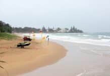
Abnormally high tides and dangerous surf conditions are expected along the southern Queensland coast over the next few days and into early next week.
Seas and swell are already increasing well ahead of the approach of Oma with dangerous surf about the east coast extending from far northern New South Wales northwards to Seventeen Seventy.
Beach erosion is likely to continue with the hazardous marine conditions.
A severe weather warning for abnormally high tides and dangerous surf is current. A hazardous surf warning is also current.
Gale force winds, with gusts greater than 90kmh, are expected to develop along exposed coastal areas of southern Queensland during Friday well ahead of Oma.
Water levels on the high tide may exceed the highest tide of the year by around one metre over the next few days.

Recommended action
- People between Bundaberg and the NSW/Qld border should consider what action they will need to take if the cyclone threat increases.
- Information is available from the Bundaberg Regional Council Disaster Dashboard.
- It's recommended that people avoid coastal parks and beaches at high tide.
- For cyclone preparedness and safety advice, visit Queensland's Disaster Management Services website (www.disaster.qld.gov.au).
- For emergency assistance call the Queensland State Emergency Service (SES) on 132 500 (for assistance with storm damage, rising flood water, fallen trees on buildings or roof damage).
A spokesman for Bundaberg Regional Council said the warnings were not unexpected given the cyclone's uncertain direction.
“People should monitor weather forecasts and local media, and heed any advice from emergency services,” the spokesman said.
Stay informed about Tropical Cyclone Oma
- Queensland weather warnings
- Bundaberg Region Disaster Dashboard
- Disaster Management Queensland
- Prepare: Get Ready Queensland


