
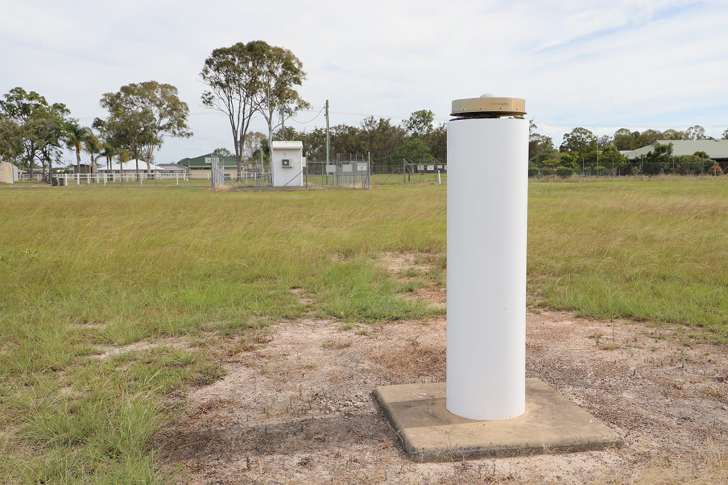
The Bundaberg Region became one of Australia’s first 20 locations to install a Global Navigation Satellite System and now the Council initiative is supporting the national GPS network.
The Federal Government and Geosciences Australia have invested in upgrading the station, located at Bundaberg Regional Airport, to help to ensure the accuracy of the national network.
The upgrade provides more reliable access to positioning technology by feeding localised data back to Geosciences Australia, improving calculations at a national scale.
Mayor Jack Dempsey said the station, first installed in about 2006, was also the first link in the network between Sydney and Townsville.
“We’re a proactive Council and it’s wonderful that this forward thinking almost two decades ago can now support this Federal Government initiative to upgrade the Global Navigation Satellite System network,” Mayor Dempsey said.
“Accurate GPS signals are so important, not just for your typical mapping uses, but to support a range of industries from construction and surveying to agtech.
“Critically, this technology is also pivotal in supporting emergency services and search and rescue operations.
“Council is pleased that this data can now benefit the rest of Australia in addition to our local residents and industries.”
Queensland Global Navigation Satellite System sites are managed jointly between Geoscience Australia and the Queensland Department of Natural Resources, Mines and Energy.
The Bundaberg station is the only station jointly operated with Bundaberg Regional Council.
With upgrades occurring throughout the state, the Bundaberg ground station was one of the first to receive upgrades to its Global Navigation Satellite System.
Federal Member for Hinkler and Minister for Resources, Water and Northern Australia Keith Pitt said the improvements would help increase productivity and open up new economic opportunities.
“GNSS ground station data from stations like the one in Bundaberg make it possible to get reliable and precise positioning down from around ten metres to just three centimetres accuracy in areas of mobile phone coverage,” Mr Pitt said.
“This level of accuracy benefits all sorts of GNSS users, such as those in the survey, agriculture, mining and construction sectors.
“The Federal Government is investing around $225 million to establish a world-class satellite positioning capability in Australia through the Positioning Australia Program, including the delivery of NPIC and a new Satellite-Based Augmentation System (SBAS).”
Australia’s new SBAS, officially named the Southern Positioning Augmentation Network, or SouthPAN, will improve the accuracy of positioning from 5-10 metres to 10 centimetres without the need for mobile or internet coverage.
- Other news: From humble beginnings Gutter-Vac grows


