
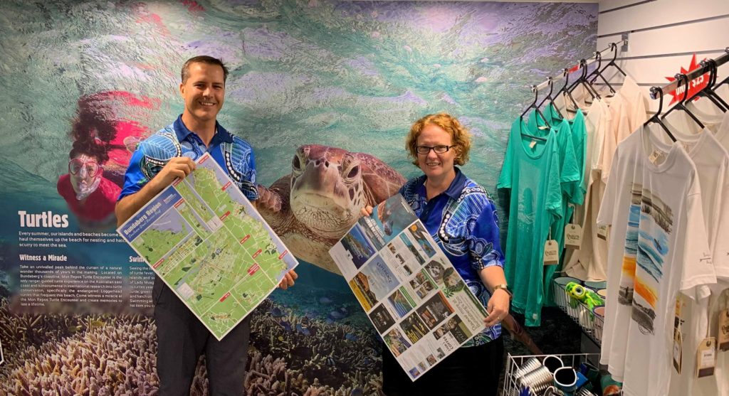
Visitors to the Bundaberg region will be able to find all the local attractions and highlights in the one place, with the launch of the 2020 Bundaberg Region Visitors Map.
While digital apps are popular, Bundaberg Tourism CEO Katherine Reid said there was still demand for a printed map.
“Despite many people relying on digital mapping apps these days to get them from A to B, we are still finding demand for the paper map to be available at Visitor Information Centres,” Katherine said.
“Our wonderful volunteer ambassadors are using the maps daily to support visitors and the vast majority of visitors request a printed map to take with them.”
100,000 maps printed
Some 100,000 of the maps have been printed and will be available to all businesses who service the needs of visitors within the Bundaberg Region for the positive promotion of the destination.
The street map covers areas throughout the region including Bundaberg, Childers, Gin Gin, Woodgate Beach, Moore Park Beach and the coastline between Burnett Heads and Elliot Heads.
“Bundaberg Tourism has been developing the regional visitors map for more than five years as a key local resource for assisting visitors in finding their way,” Katherine said.
“As a local visitor servicing tool, we aim for the visitor map to be a ‘cost neutral’ project, with advertising paying for the print and design costs, so we are incredibly grateful for the businesses that advertise on the map year after year.
“It’s fantastic to see that many businesses include a dedicated call to action on their advertisement so that they can measure its return on investment.”
The Bundaberg Region Visitor Maps are available to pick up from the Bundaberg, Childers and Gin Gin Visitors Centres.
- More tourism news


