
The Bundaberg Region is well-known for its beautiful beaches and picturesque coastal areas, but do you know the history behind their names?
What are now bustling and thriving oceanside suburbs were once open spaces waiting to be discovered- and that they were.
Take a look back at the interesting history behind some of our beachside locations thanks to the Bundaberg Regional Libraries heritage team.
Moore Park Beach
Moore Park Beach as we know it today features a beautiful beachside, shops and residential areas, but it was once part of an area called Tantitha Station.
Tantitha went through several hands before belonging to the Moore brothers who then made ‘Moore Park’ land available to Gooburrum Shire Council.
The area’s reputation for fishing grew and the population swelled to hundreds during weekends as more people discovered the hideaway.
Gradually more land became available for residential settlement and the town grew.
In 2002 the local Community Association asked for a review of the town’s name and in 2005 its name was formally changed to Moore Park Beach.
Burnett Heads
After failed attempts to locate where the river met the sea, surveyor and explorer James Charles Burnett returned to the region in 1847 by boat and found the mouth of the (now) Burnett River.
Sir Charles Fitzroy, Governor of New South Wales, officially named it the Burnett River on 7 September 1847.
Originally known as Wallace Town (John and Michael Wallace were among the first settlers of the area), the name Burnett Heads most likely came about due to common usage.
As the head of the Burnett River, in the early days the locality was often referred to as the Burnett Heads.
This then morphed into the shorter form ‘Burnett Heads’.
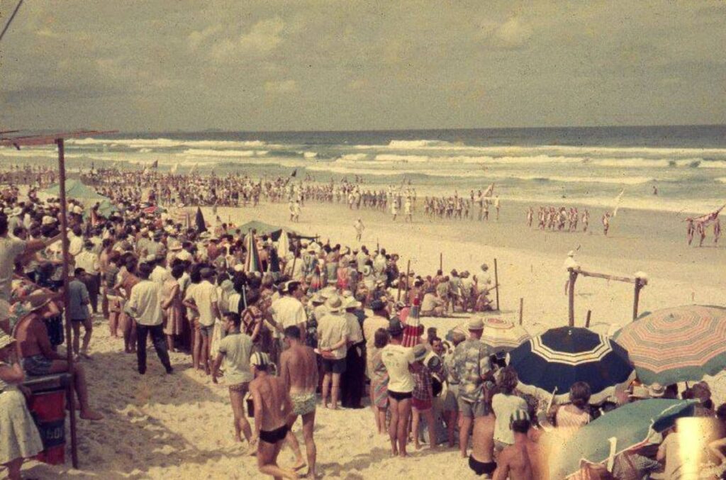
Nielson Park
Nielson Park was once part of a 1200 acre pasturage reserve which, in 1912, Woongarra Shire Council designated a large portion of as Nielson Park.
The area was named after Charles Frederick Nielson.
Born in Denmark Charles was educated in Bundaberg and Maryborough and practiced as a solicitor in Bundaberg.
Heavily involved in the sugar industry and serving as a director of the Bundaberg Foundry Co., Nielson was also elected to State parliament as the member for Musgrave from 1904-1907.
From about 1914 Council started to develop the area as a tourist resort.
The Council used to operate free excursion trains to Neilson Park, and after a drowning at the beach in 1916, a team of ‘proficient swimmers’ also travelled by the trains to look out for the public.
This free travel ceased in 1918 when the State Government took over the rail line.
It prompted the formation of the Bundaberg Surf Lifesaving Club which has its headquarters at Nielson Park.
Other memories of Nielson Park include the regular Railway Picnics from approximately 1922- 1972 and the roller skating rink.
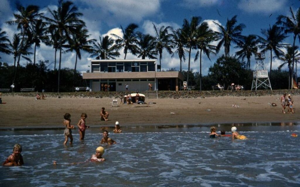
Bargara
Originally known as Sandhills, Bargara was part of Barolin Station, held by A & A.H.Brown.
In 1889 land development began in earnest and allotments in ‘Sandhills Estate’ went on
sale.
In 1913 the new Woongarra Tramway was inspected by the then Queensland Government Railways Commissioner.
He declared that Sandhills should change its name to Bargarra, after the two local government authorities – Barolin and Woongarra.
Over time, the spelling has changed from Bargarra to Bargara, and the pronunciation from Bar-garra to B’gara.
The main streets for Sandhills were originally named, with one exception, after fish.
Bauer St was Mullett St, See St was Dolphin St, Tanner St was Barramundi St, Grimwood St was Baracouta St, and Croft St was Bonito St.
The odd one out was Platypus Street which is now Holland St.
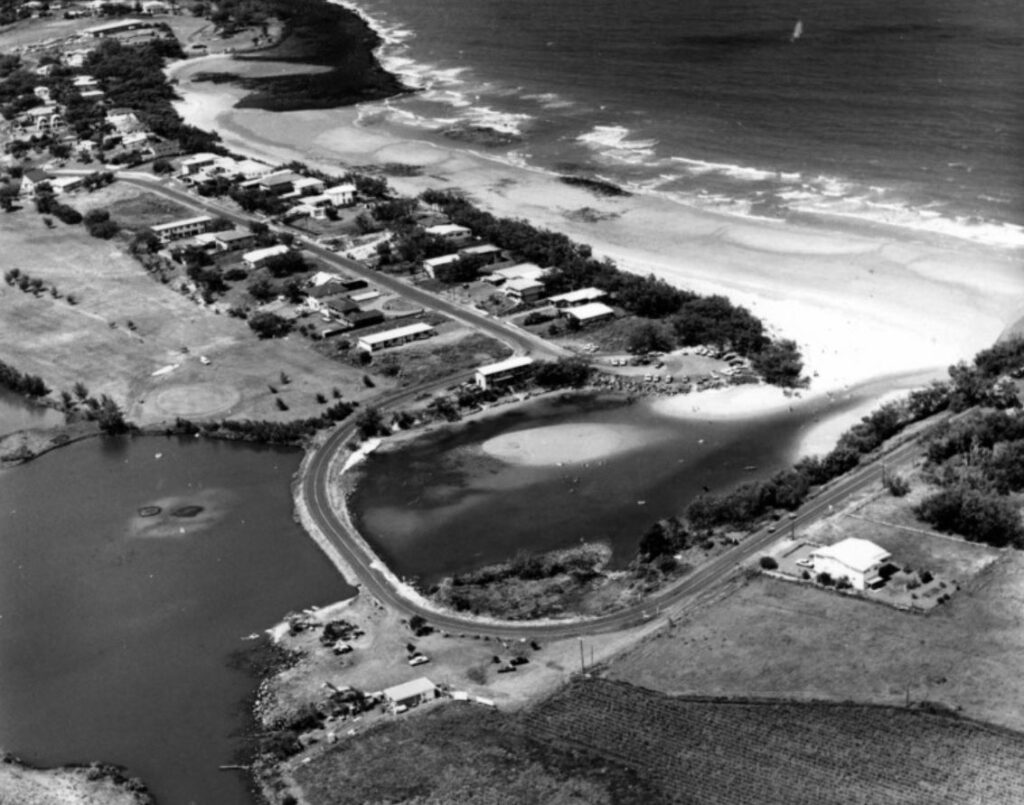
Elliott Heads
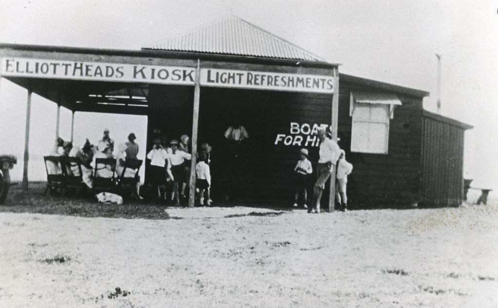
Maryborough Harbour Master Richard B. Sheridan explored the Elliott River in 1861.
He decided to name it after Gilbert Eliot, a man who had taken up pastoral leases in the Wide Bay and represented Burnett in the NSW Legislative Assembly.
Eliot was opposed to Queensland separating from NSW but won the seat of Wide Bay in 1860 and was chosen as the Parliament’s first speaker.
Elliott Heads takes its name from the Elliott River.
Originally known as Springfield, the name Elliott Heads most likely came about through common usage in referring to the head of the Elliott River.
The name was officially changed by the Queensland Place Names Board on 1 Nov 1967.


Great history provided here. Myself and many others will have very fond memories of those places and the times we had at them.
Thank you to everyone who took time to put together this history …..I grew up in Bundaberg and remember the beaches as they were in the 60’s, 70’s, however, I have never known the stories of the era.
A very interesting read-I only lived in Bargara from 1990-2014,but loved every minute there .Health and age forced us to return” down South” to be nearer family in 2014.
it was not Moore Park when i was a kid. you went to the North Coast. a bit of study would show that Tantitha initially was something quite different. Santitha and Welcome Creek were initially involved. Tantitha was a separate run that ultimately became the consolidated name. the coast was a reserve, but that got done over by greedy pastoralists. how many people have ever seen those early surveys that date into the 1870 era. Moore gave farm land for soldier resettlement. to get to the coast, you had to cross the creek, cord wood for a while that i recall, and could be a bit dodgy at times. the creeks initially entered the sea just to the south of the beach, but fairymead tried to change that. as to A & A.H. Brown and Barolin, old documents show that there was a very big stink over this. they are at the Queensland Archives.
Once again Coonarr doesn’t warrant a mention. Best beach in the wideband and also the most forgotten when it comes to our regional council.
Where is Palmer’s Creek? Shelley Beach, the Oaks beach? Coonarr? Kelly’s creek beach? Mon Repos?
Robert, i sent in a piece on Coonarr. i had found the Survey plans of the township recently. it was surrounded by “Hall Country.” Plenty of Bait Fish and Shark in those days. just to the north on the South Head of the Elliott River, the plan also showed where Dr. May’s block of land was. there is also a reef recorded on that plan.