
A range of flood study projects will allow Bundaberg Regional Council to not only finetune its own strategies and systems but also support surrounding Local Government areas.
Council was awarded the funding following the impacts of Ex-Tropical Cyclone Seth in January 2022 under the Queensland Reconstruction Authority’s Disaster Recovery Funding Arrangements.
A total of $18.25 million was awarded to 36 Councils throughout the state for 127 projects.
Of this Bundaberg Regional Council secured more than $2.6 million to undertake:
- Bundaberg Region Flood Risk Assessment and Planning Evaluation
- Burnett River and Tributaries Catchment Flood Study and targeted bathymetric and survey data collection
- Bundaberg Flood Intelligence System
Mayor and Local Disaster Management Group chair Jack Dempsey said receiving such a significant portion of the available funding was a coup for the Bundaberg Region.
“This funding is recognition that Bundaberg Regional Council has proven ability in delivering best practice flood risk assessment and management strategies,” Mayor Dempsey said.
“Thanks to this funding we can now share our learnings and experience with neighbouring Councils as we work together to improve our understanding of flooding across the Burnett catchment.
“The funding will also be used to update available data of the region, create a flood console to support emergency management and expediate Council’s response to issues during significant localised rain events.
“This will ensure our community has the most up-to-date information and resources available to support them in any emergency situation.”
The flood study funding will allow Bundaberg Regional Council to undertake:
Bundaberg Region Flood Risk Assessment and Planning Evaluation
- This project will cover riverine, creek and overland flood risk and will provide:
o Clear and consistent flood risk mapping
o A natural hazards, risk and resilience evaluation
o A feasible alternatives assessment
o Land use planning controls - This data will then be incorporated into the region’s next planning scheme which is required to be reviewed by October 2025
- The project will also include the preparation of educational material to improve community awareness of flood risk
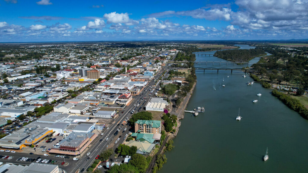
Burnett River and Tributaries Catchment Flood Study
- Bundaberg Regional Council will lead this regional study in partnership with Gympie, North Burnett, Cherbourg and South Burnett Regional Councils
- Hydrologic and hydraulic models and design event modelling and mapping will be produced
- This project will incorporate targeted bathymetric and survey data collection across the Burnett catchment.
Bundaberg Flood Intelligence System
- This part of the funding will cover urban areas of Bundaberg and coastal community from Burnett Heads to Elliott Heads
- An integrated flood console and flood intelligence dashboard will be developed to improve Council’s emergency management and response to flash flooding
In addition to improved disaster response for the Bundaberg region Mayor Dempsey said there was significant benefit for ratepayers as the funding meant the Federal and State Governments would cover the cost to update important data that Council would otherwise be required to fund for the next planning scheme.
“The funded projects are aligned with Council’s overarching disaster management strategies and will play an important role in the region’s future disaster response and resilience,” he said.
When the funding was announced Federal Minister for Emergency Management Murray Watt said the program aimed to provide long-term assistance to better protect communities into the future.
“This funding enables councils to understand and mitigate flood risk through flood studies, risk assessments and management strategies,” Minister Watt said.
“Optimising an area’s flood resilience requires knowing what will work best based on the available data and modelling, and we are pleased to deliver the tools councils need to make this happen.”
Deputy Premier and Minister responsible for the Queensland Reconstruction Authority Steven Miles said he wanted Queensland to continue to lead the country in building resilience through programs like this.
The projects are jointly funded by the Australian and Queensland Governments under the Disaster Recovery Funding Arrangements.


i just ordered 10 or so survey maps dealing with the Burnett River found in the archives from an early period. Floods were probably then more frequent and just as devastating. i can’t wait for these to arrive so it can be seen just how much the river has been screwed up.
10 years on and we are still spending assessment millions after the assessment millions already spent. When do we see actual, physical resilience measures in place… you know, the ones that have been recommended since 2013.
Comments are closed.